| Map Description Historical Map of India 1700-1792 Illustrating
Credits University of Texas at Austin. Historical Atlas by William Shepherd (1911). Related Maps 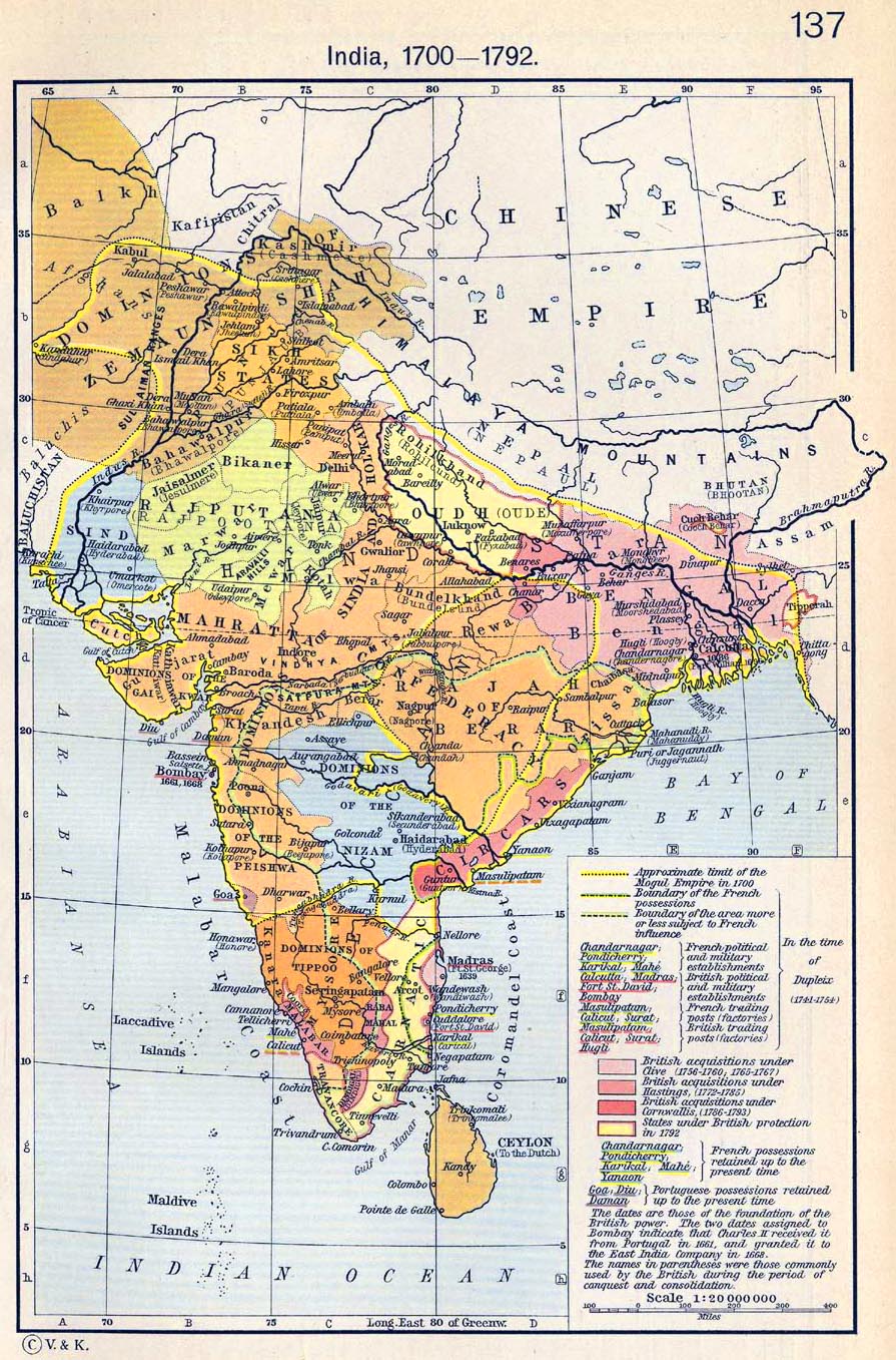 | |||||
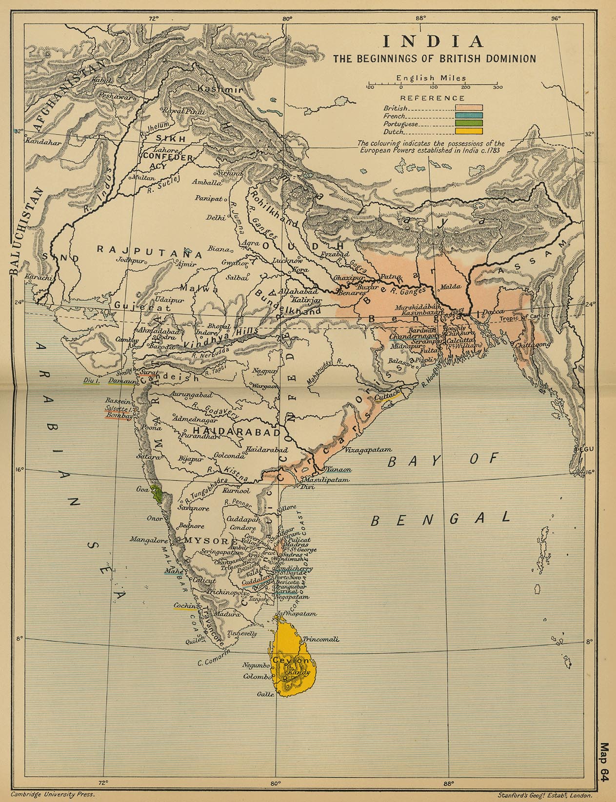
Map Description
Historical Map of India: The Beginnings of the British Dominion
Historical Map of India: The Beginnings of the British Dominion
Illustrating
Pink - British
Blue - French
Green - Portuguese
Yellow - Dutch
The coloring indicates the possessions of the European Powers established in India c. 1783.
Credits
University of Texas at Austin. From the Cambridge Modern History Atlas, 1912.
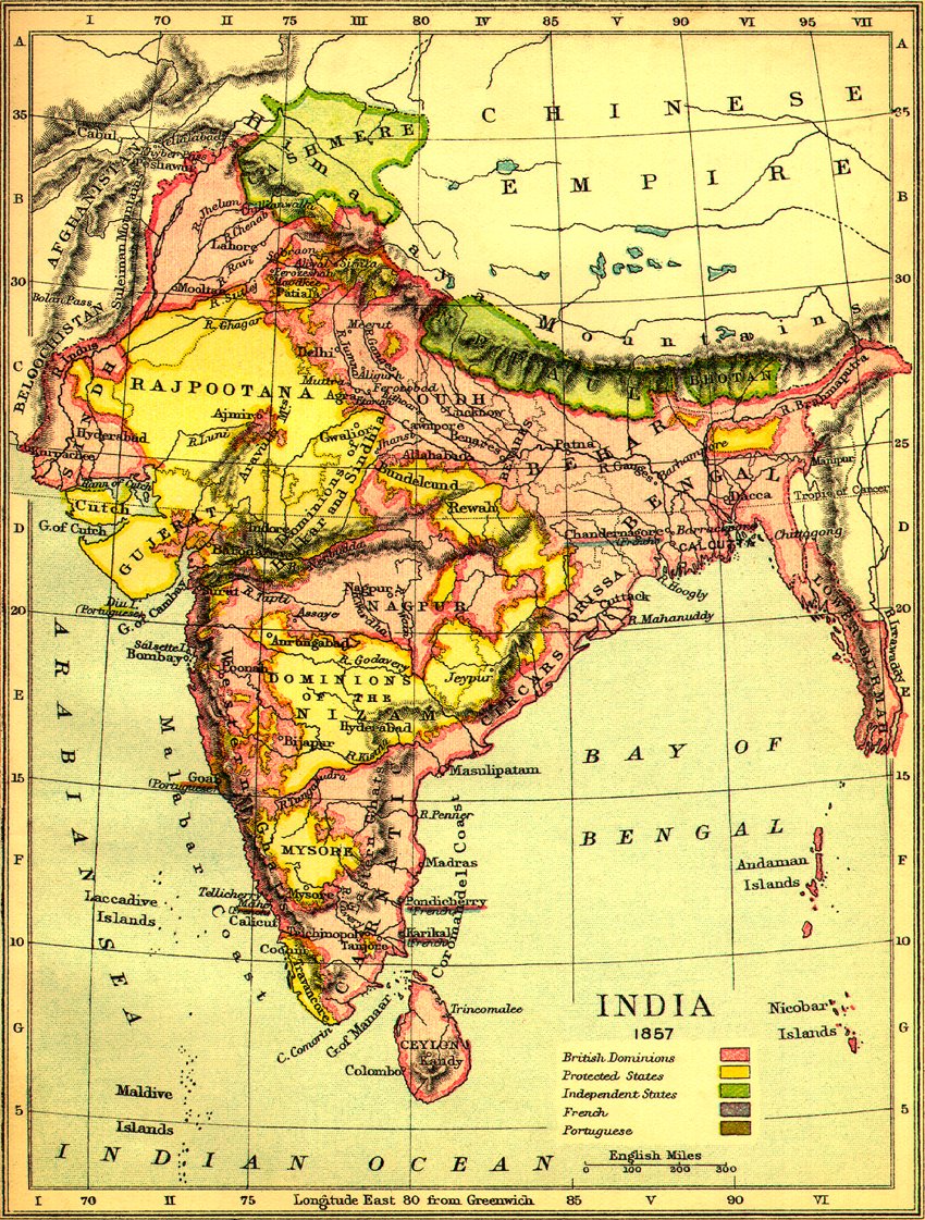
Map Description
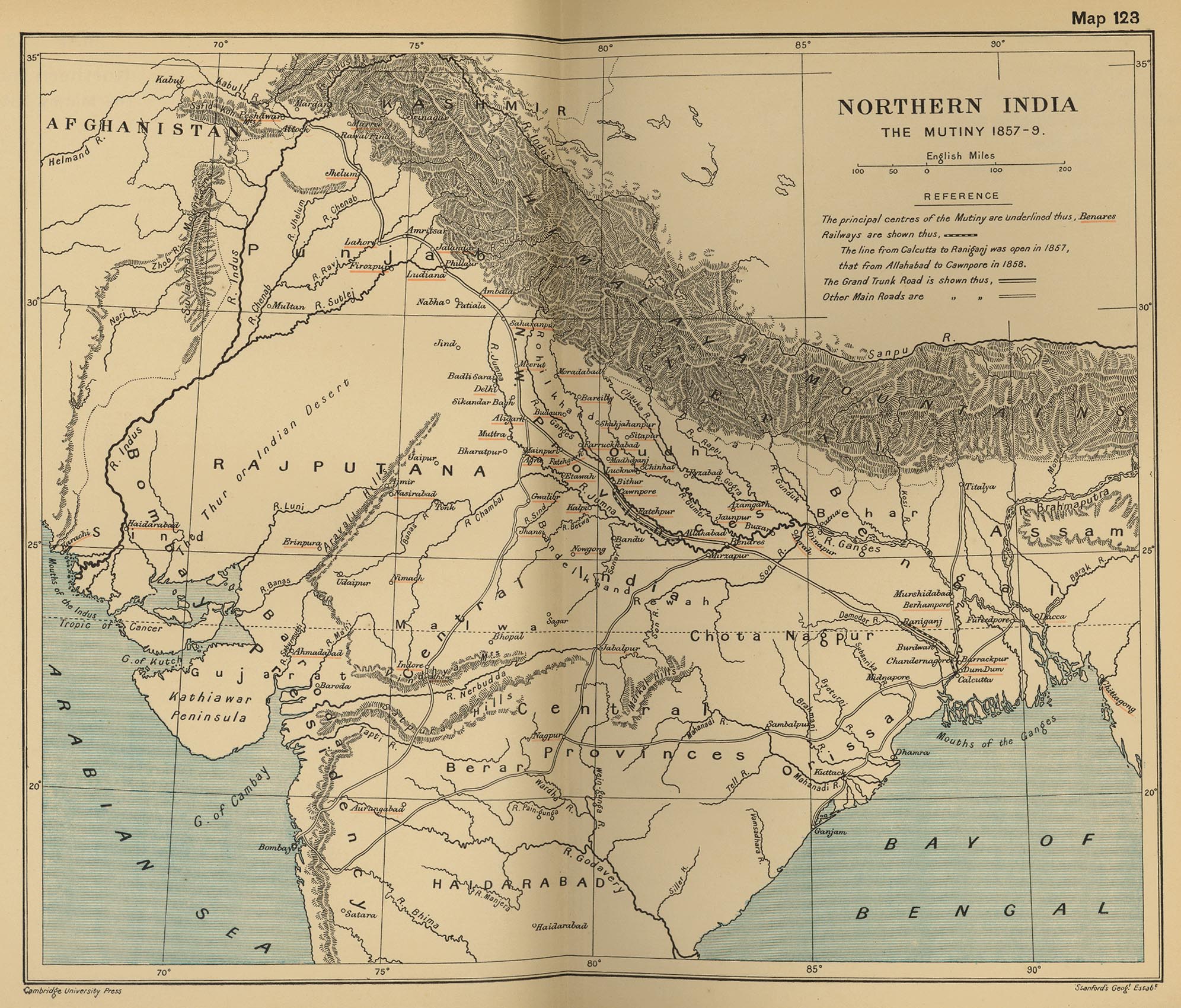
Historical Map of Northern India: The Mutiny 1857-1859
Historical Map of Northern India: The Mutiny 1857-1859
Illustrating
- The principal centers of the Mutiny
- Railways: The line from Calcutta to Raniganj was open in 1857, that from Allahabad
to Cawnpore in 1858.
- The Grand Trunk Road
- Other main roads
Credits
University of Texas at Austin. From the Cambridge Modern History Atlas, 1912.


India to 500 BCE

No comments:
Post a Comment